 |
| That big rock under water in the middle of the river ... I bet there's a smallmouth bass hiding there. |
After a failed attempt* at fishing the Potomac River yesterday, I opted to hit the Little Patuxent River today. I didn't hit the secret location but tried a section upriver that I tried once last year. Worked out pretty good as I landed three smallmouth in about two hours with the biggest one (and the first fish) being just over 14 inches.
 |
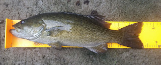
| 14.5" Little Patuxent smallmouth bass |
In the photo at the top of the page, you can see a large rock submerged in the middle of the river. I was using a Z-Man Finesse TRD worm and cast it just in front of the larger rock on shore on the other side of the river. Hopping the worm back on the bottom of the river, I hopped it on top of the big rock in the river, and just as soon the jig fell down back to the bottom of the river, this smallmouth came charging from the left across the top of the rock and snatched the worm! Apart from a topwater strike, there's nothing like seeing a fish screaming from out of nowhere to attack your lure!
 |
| '10-11' smallmouth |
I also tried a black Hubs Chub and was getting some interest, but I think they were nibblers -- one might have been a failfish -- who realized the lure wouldn't fit in their mouth right before nomming on the trailing treble hook.
Later, while climbing over some rocks in the middle of the river, I spotted a small smallmouth bass just upriver in front of this rocky section. But it couldn't be tricked into biting anything.
But three smallmouth bass with one being decent size is a pretty good outing on the Little Patuxent. I keep wondering if there's anything in the 18-inch range somewhere. There's almost zero fishing pressure on the river -- today was another day where I didn't see anybody else fishing. I've caught a handful more than 15 inches, and there was a post on the Maryland DNR Angler's Log of someone catching a 17-incher in the Odenton area. So ... maybe ...
* About the aborted mission on the Potomac, I had been monitoring the gauges all week, and the water levels were going down. First thing Saturday morning, checked the gauges and they were steady in Williamsport and Point of Rocks. Figured I'd try the Lander Road boat ramp for the first time and headed out around noon. When I got there, the river didn't look right. Scouting the location on Google Earth showed rocks protruding from the water in the middle of the river, so I figured it was fairly shallow area ... only no rocks were visible when I ambled up to the top of the bank. I whipped out my phone to check the gauge readings at americanwhitewater.org, and the river had gone up three feet since early this morning, about four to five hours before arriving on site! I guess there had been rain in West Virginia and/or western Maryland over the past couple days while there had not been any precipitation for the past week or so where I lived.
No comments:
Post a Comment